Many people are unaware of the tremendous amount of ruins, artifacts, and remains of the ancient Nephites and Lamanites that have been found in America and Canada, especially by early settlers. There were many mounds and earthworks and fortifications and many books have been written about these — but it is not widely known. The first and most famous book is Ancient Monuments of the Mississippi Valley: Comprising the Results of Extensive Original Surveys and Explorations (1848) by Ephraim George Squier and Edwin Hamilton Davis, with 306 pages, 48 lithographed maps and plates, and 207 wood engravings in the original book. This link is to a .pdf file scan of the original. A faster, easier version for viewing is found online. Below at the end of this page are two examples from the Book.
Discovering the Walls of Zarahemla
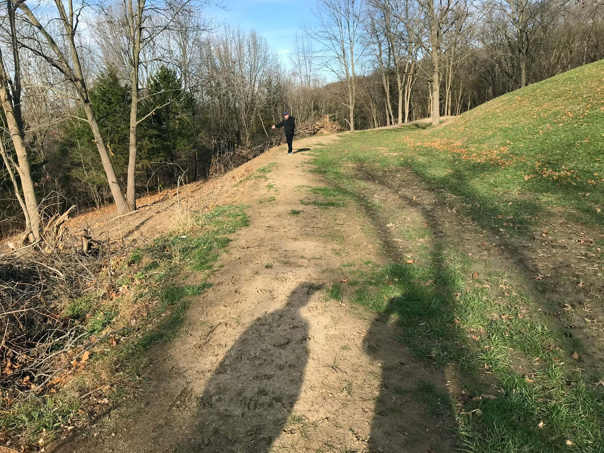
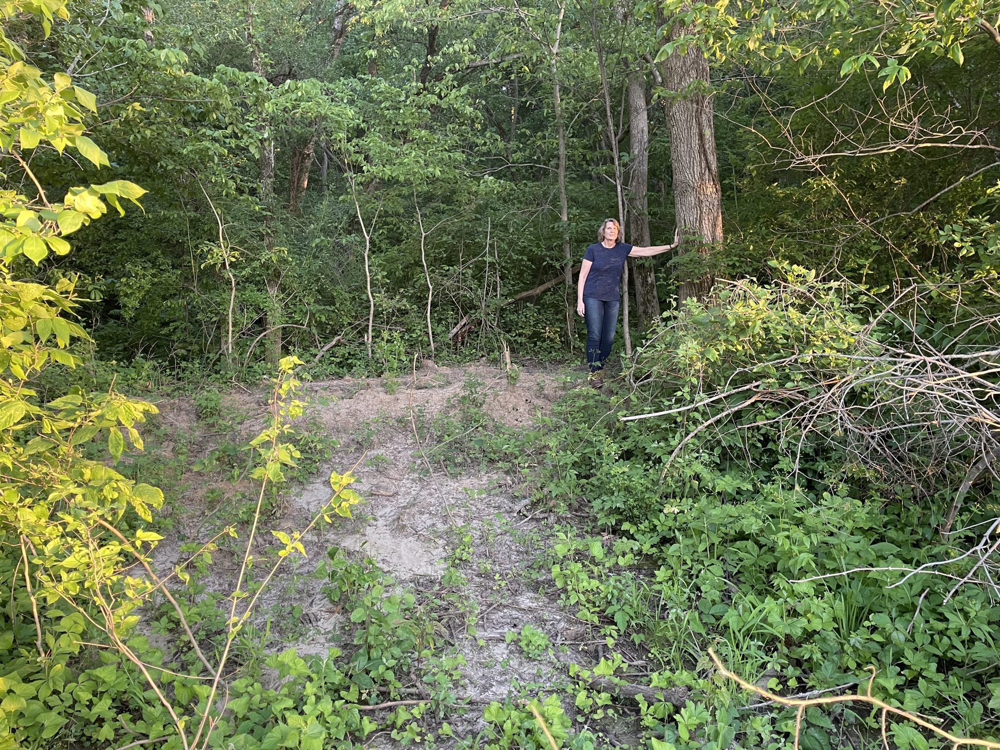
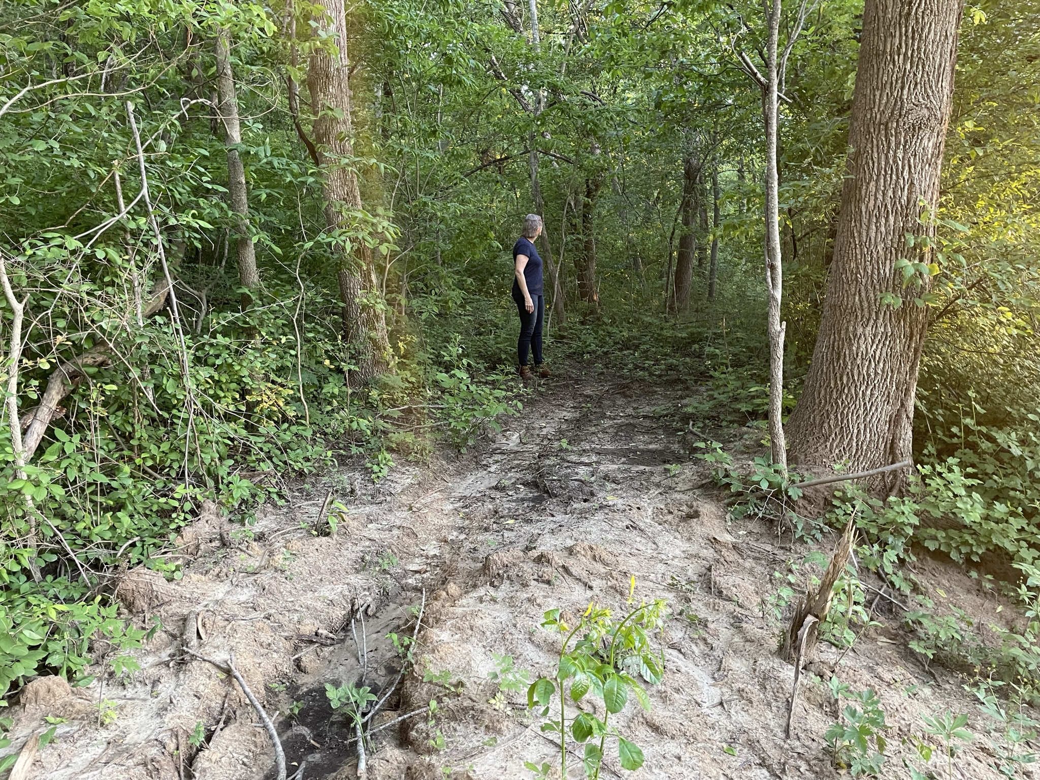
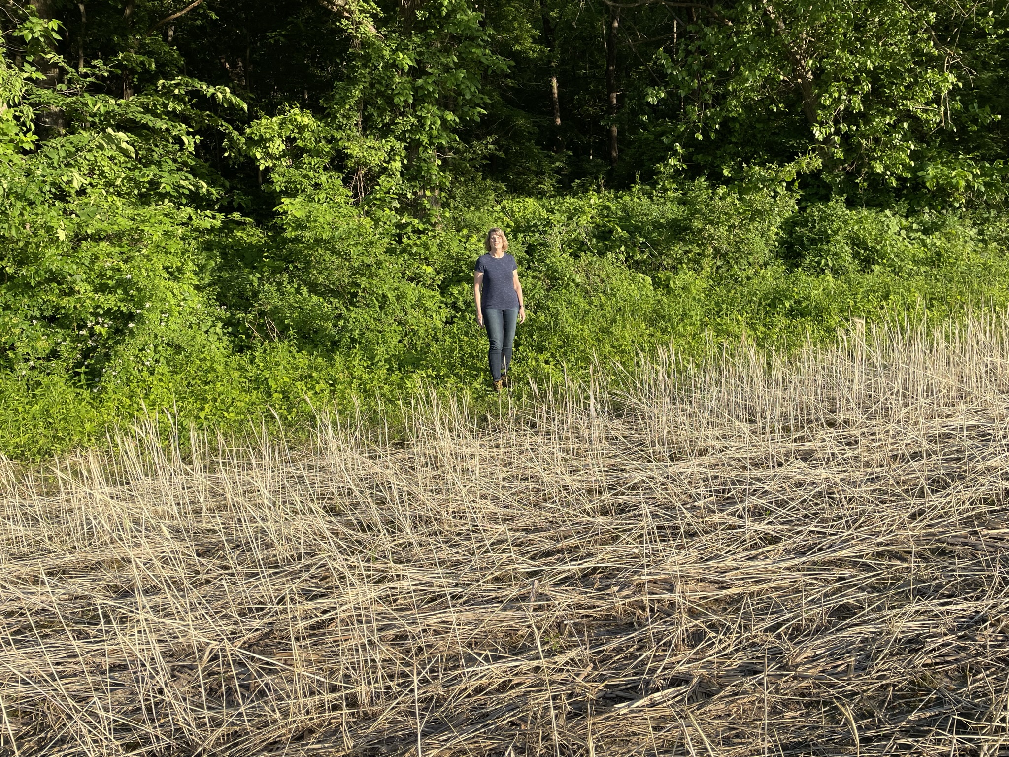
April 3 2022. Boots on the ground research work began for the wall foundations of Zarahemla.
Timeline
The following has been reported from the expedition team:
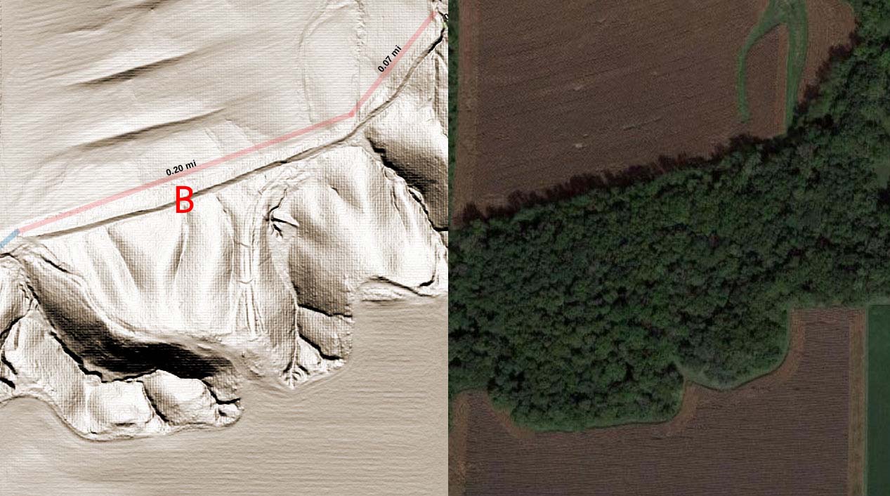
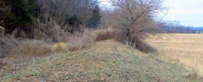
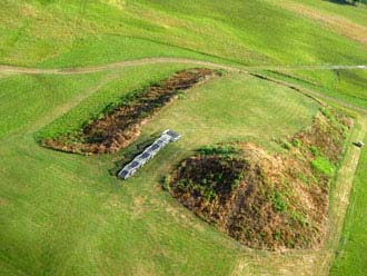
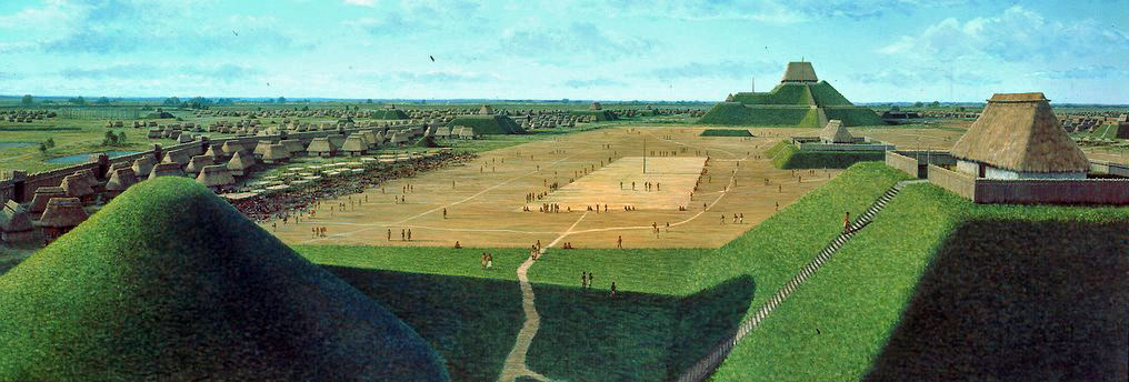
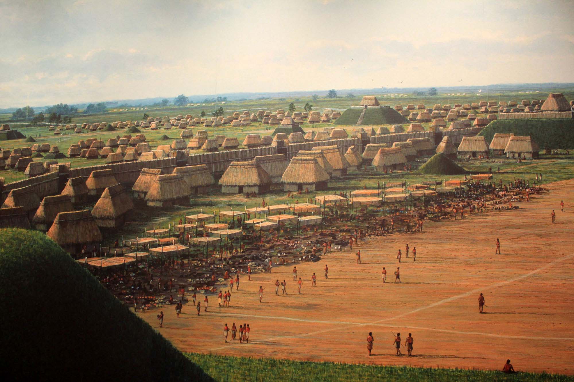
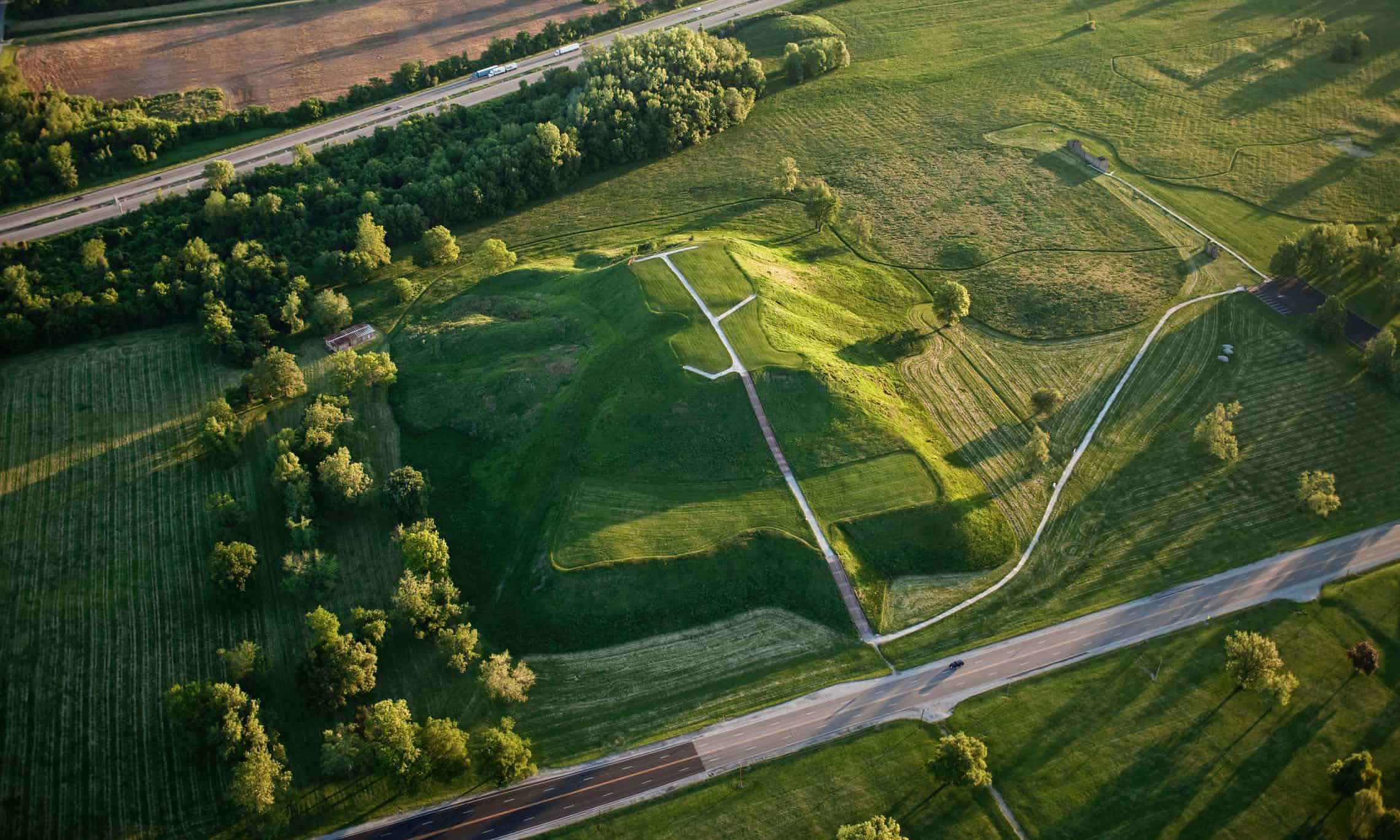
Research is ongoing but so far I think there is a general consensus that these berms are man-made, not of modern construction, and have the potential to be part of the wall defenses of the ancient city of Zarahemla and that it is worth our continued study and exploration (especially when the weather is better). The berms are where we would expect the walls to be for the ancient city of Zarahemla. A description of the construction of defensive walls is given in the Book of Mormon. The image below is just one possible view of interpretation but it gives an idea of what we are considering and finding on the ground. 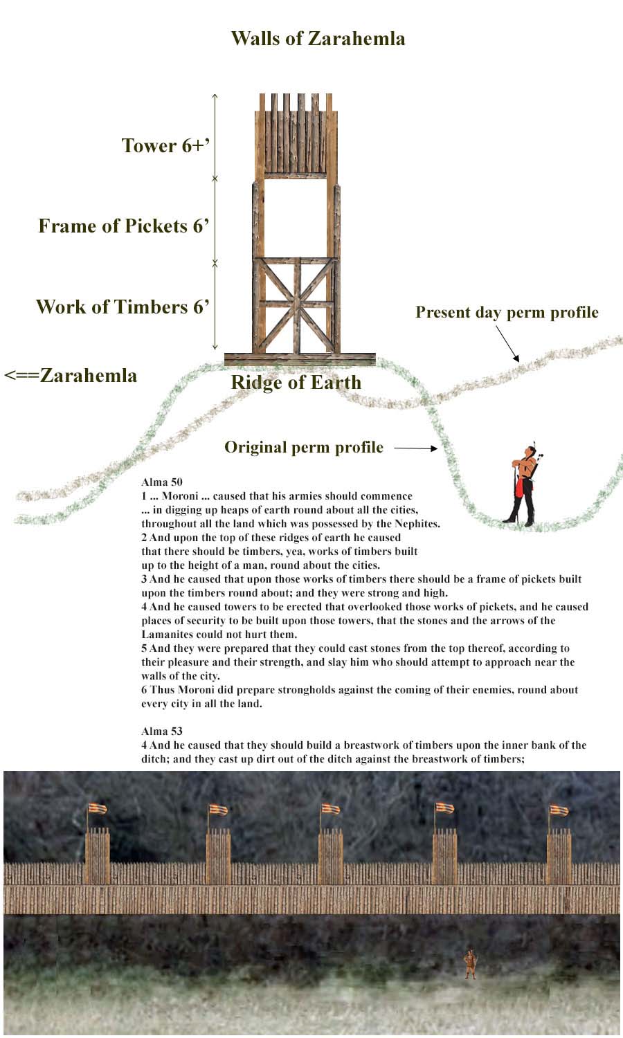


|
One one short expedition in March of 2022 has been undertaken so far to visually inspect a very short section of
a wall berm that may have once formed a foundation for the walls of Zarahemla.


|
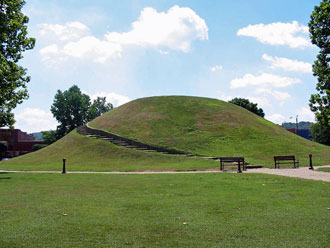
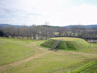
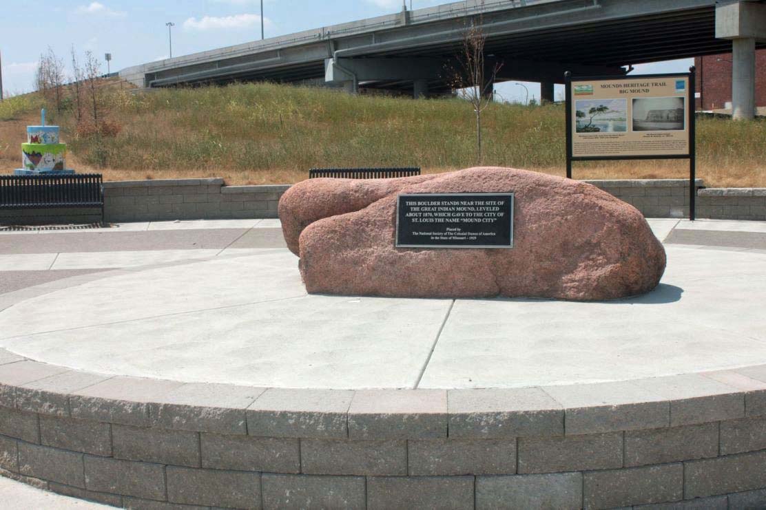
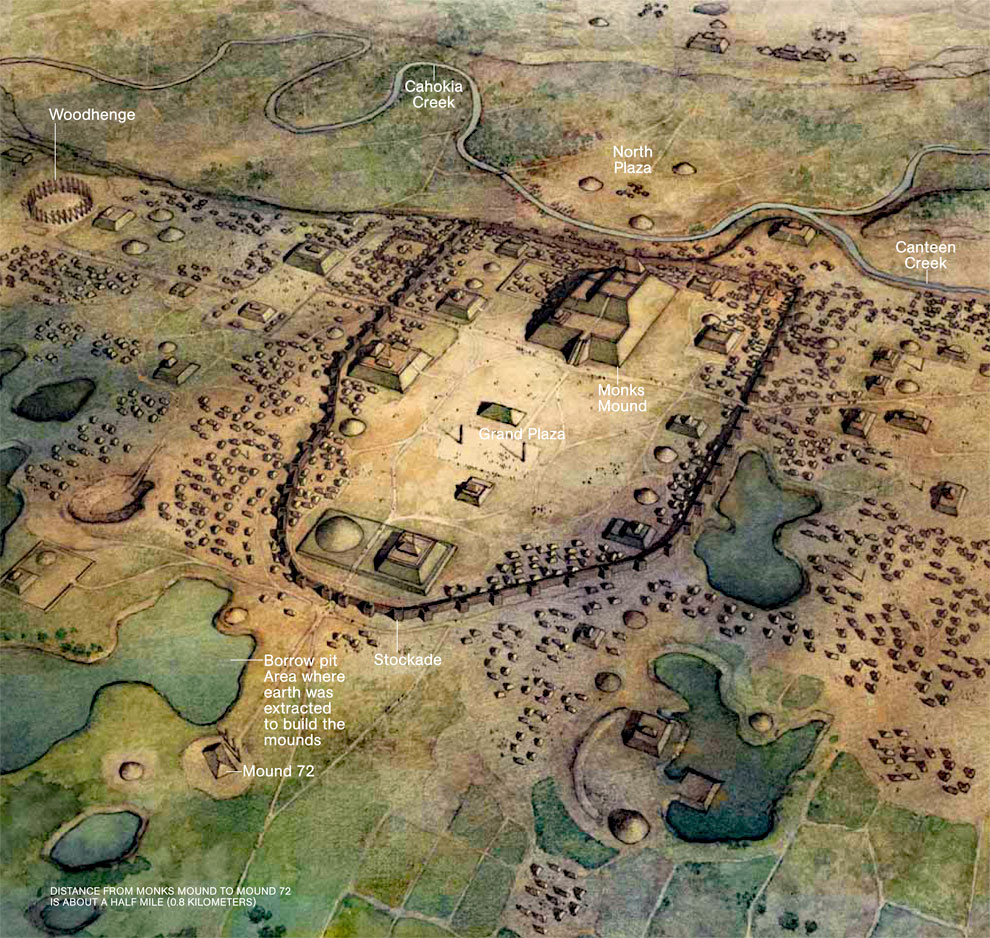
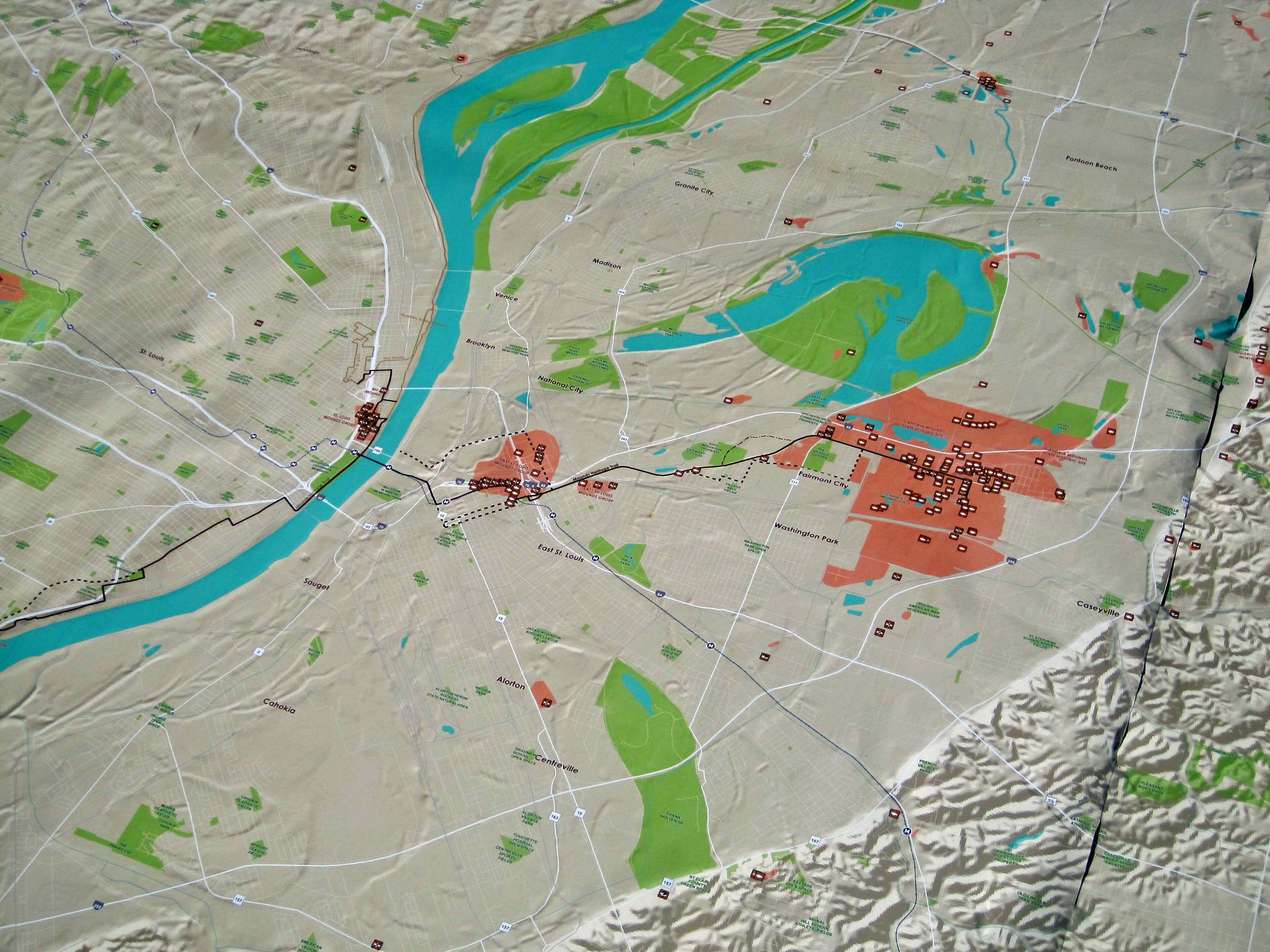
Other Mounds and Earthworks
|
|
|
|
|
|

|
|
|
|
|
|
|
|
|
|
|
|
|
|
|
|
|
|

|
|
|
|
|
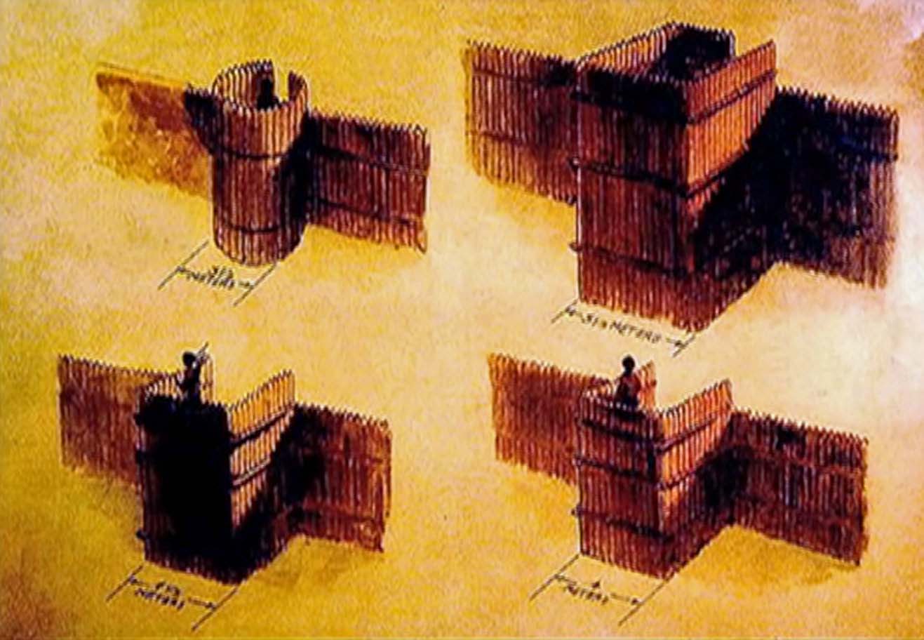
Alma 50
1 And now it came to pass that Moroni did not stop making preparations for war, or to defend his people against the Lamanites; for he caused that his armies should commence in the commencement of the twentieth year of the reign of the judges, that they should commence in digging up heaps of earth round about all the cities, throughout all the land which was possessed by the Nephites.
2 And upon the top of these ridges of earth he caused that there should be timbers, yea, works of timbers built up to the height of a man, round about the cities.
3 And he caused that upon those works of timbers there should be a frame of pickets built upon the timbers round about; and they were strong and high.
4 And he caused towers to be erected that overlooked those works of pickets, and he caused places of security to be built upon those towers, that the stones and the arrows of the Lamanites could not hurt them.
5 And they were prepared that they could cast stones from the top thereof, according to their pleasure and their strength, and slay him who should attempt to approach near the walls of the city.
6 Thus Moroni did prepare strongholds against the coming of their enemies, round about every city in all the land.
2 Nephi 5
16 And I, Nephi, did build a temple; and I did construct it after the manner of the temple of Solomon save it were not built of so many precious things; for they were not to be found upon the land, wherefore, it could not be built like unto Solomon’s temple. But the manner of the construction was like unto the temple of Solomon; and the workmanship thereof was exceedingly fine.
2 Nephi 53
3 And it came to pass that after the Lamanites had finished burying their dead and also the dead of the Nephites, they were marched back into the land Bountiful; and Teancum, by the orders of Moroni, caused that they should commence laboring in digging a ditch round about the land, or the city, Bountiful.
4 And he caused that they should build a breastwork of timbers upon the inner bank of the ditch; and they cast up dirt out of the ditch against the breastwork of timbers; and thus they did cause the Lamanites to labor until they had encircled the city of Bountiful round about with a strong wall of timbers and earth, to an exceeding height.
5 And this city became an exceeding stronghold ever after; and in this city they did guard the prisoners of the Lamanites; yea, even within a wall which they had caused them to build with their own hands. Now Moroni was compelled to cause the Lamanites to labor, because it was easy to guard them while at their labor; and he desired all his forces when he should make an attack upon the Lamanites.
Note that in the following verses (Alma 47), the word “mount” in Bible-like English is a man-made structure and means “mound” in modern English.
Alma 47
5 And now he had got the command of those parts of the Lamanites who were in favor of the king; and he sought to gain favor of those who were not obedient; therefore he went forward to the place which was called Oneidah, for thither had all the Lamanites fled; for they discovered the army coming, and, supposing that they were coming to destroy them, therefore they fled to Oneidah, to the place of arms.
6 And they had appointed a man to be a king and a leader over them, being fixed in their minds with a determined resolution that they would not be subjected to go against the Nephites.
7 And it came to pass that they had gathered themselves together upon the top of the mount which was called Antipas, in preparation to battle.
8 Now it was not Amalickiah’s intention to give them battle according to the commandments of the king; but behold, it was his intention to gain favor with the armies of the Lamanites, that he might place himself at their head and dethrone the king and take possession of the kingdom.
9 And behold, it came to pass that he caused his army to pitch their tents in the valley which was near the mount Antipas.
10 And it came to pass that when it was night he sent a secret embassy into the mount Antipas, desiring that the leader of those who were upon the mount, whose name was Lehonti, that he should come down to the foot of the mount, for he desired to speak with him.
11 And it came to pass that when Lehonti received the message he durst not go down to the foot of the mount. And it came to pass that Amalickiah sent again the second time, desiring him to come down. And it came to pass that Lehonti would not; and he sent again the third time.
12 And it came to pass that when Amalickiah found that he could not get Lehonti to come down off from the mount, he went up into the mount, nearly to Lehonti’s camp; and he sent again the fourth time his message unto Lehonti, desiring that he would come down, and that he would bring his guards with him.
Alma 49
18 Now behold, the Lamanites could not get into their forts of security by any other way save by the entrance, because of the highness of the bank which had been thrown up, and the depth of the ditch which had been dug round about, save it were by the entrance.
19 And thus were the Nephites prepared to destroy all such as should attempt to climb up to enter the fort by any other way, by casting over stones and arrows at them.
20 Thus they were prepared, yea, a body of their strongest men, with their swords and their slings, to smite down all who should attempt to come into their place of security by the place of entrance; and thus were they prepared to defend themselves against the Lamanites.
21 And it came to pass that the captains of the Lamanites brought up their armies before the place of entrance, and began to contend with the Nephites, to get into their place of security; but behold, they were driven back from time to time, insomuch that they were slain with an immense slaughter.
22 Now when they found that they could not obtain power over the Nephites by the pass, they began to dig down their banks of earth that they might obtain a pass to their armies, that they might have an equal chance to fight; but behold, in these attempts they were swept off by the stones and arrows which were thrown at them; and instead of filling up their ditches by pulling down the banks of earth, they were filled up in a measure with their dead and wounded bodies.
23 Thus the Nephites had all power over their enemies; and thus the Lamanites did attempt to destroy the Nephites until their chief captains were all slain; yea, and more than a thousand of the Lamanites were slain; while, on the other hand, there was not a single soul of the Nephites which was slain.
The Story of Zelph
Heber C. Kimball
On Tuesday the 3rd we went up several of us with Joseph Smith Jr to the top of a mound on the bank of the Illinois river which was several hundred feet above the river and from the summit of which we had a pleasant view of the surrounding country. We could overlook the tops of the trees on to the meadow or prairie on each side the river as far as our eyes could extend which was one of the most pleasant scenes I ever beheld. On the top of this mound there was the appearance of three altars which had been built of stone one above another according to the ancient order and the ground was strewn over with human bones. This caused in us very peculiar feelings to see the bones of our fellow creatures scattered in this manner who had been slain in ages past. We felt prompted to dig down into the mound and sending for a shovel and hoe we proceeded to move away the earth. At about one foot deep we discovered the skeleton of a man almost entire and between two of his ribs we found an Indian arrow which had evidently been the cause of his death. We took the leg and thigh bones and carried them along with us to Clay county. All four appeared sound. Elder B Young has yet the arrow in his possession. It is a common thing to find bones thus drenching upon the earth in this country. The same day we pursued our journey. While on our way we felt anxious to know who the person was who had been killed by that arrow. It was made known to Joseph that he had been an officer who fell in battle in the last destruction among the Lamanites and his name was Zelph. This caused us to rejoice much to think that God was so mindful of us as to show these things to his servant. Brother joseph had enquired of the lord and it was made known in a vision.
(Times and Seasons, 1845, Extracts from Wilford Woodruffs Journal)
Heber C. Kimball
During our travels we visited many mounds thrown up by the ancient inhabitants of Nephites and Lamanites. This morning we went unto a high mound near the river. Joseph and many of the brethren went up. This mound was very high. From the top of it we could overlook the tops of the trees as far as our vision could extend and the scenery was truly delightful. On the top of the mound were stones which presented the appearance of three alters having been erected one above the other according to the ancient order of things and human bones were strewn upon the ground. We had taken a shovel along with us. Brother Joseph wished us to dig into the mound. We dug into it about one foot and came upon the skeleton of a man almost entire and an arrow was found sticking in his back bone. Elder Milton Holmes picked it out and brought it into camp with one of his leg bones which had been broken. He put the leg bones in my wagon and I carried it to Clay County Missouri. Brother Joseph feeling anxious to learn something governing the man prayed to the lord and the lord gave him a vision in open day while lying in his wagon. This mound and his history was placed before him. His name was Zelph. He was a white Lamanite. The curse had been taken off from him because of his faith and righteousness. He had embraced the gospel. He was a short stout thick set man. He had been a great warrior, had joined the Nephites and fought for them under the direction of the great Onandagus who held sway and command over the armies of the Nephites from the hill Cumorah and eastern sea to the rocky mountains. Though the Book of Mormon does not speak of him, he was a great warrior leader and great prophet. Zelph had his thigh bone broken from the sling of a stone while in battle. In the yr of his youth he was killed with the arrow sticking in his back bone. The vision of the great prophet at the time that Zelph was killed was opened to the Prophet Joseph and their bodies were heaped upon the earth and that great mound of near 300 feet high placed over them. I felt impressed to bury Zelphs thigh bone in temple block at Jackson County Missouri but I did not have an opportunity and I brought it to clay county near the house owned by Colonel Arthur & occupied by Lyman Wight.
(Wilford Woodruff, autobiographical account, recorded in his daily journals prepared for publication by Matthias Mowley, The Deseret News, Salt Lake City, Utah, 1909, page 41)
|
|