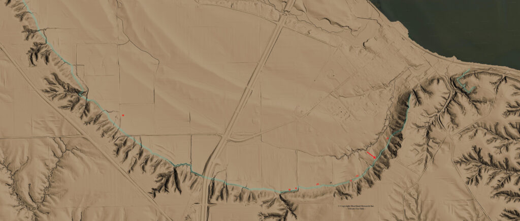
The image above is constructed from high resolution LiDAR files. Earthworks are prominent in the southwest corner of the plains area which may be the remains of ancient fortifications (i.e. the Walls of Zarahemla). The berms which extend, on and off for 10 miles, are dated to be definitely prior to 1878 via Dendrochronology. Future archeological excavations will establish a C14 date. The earthworks are not visible with satellite imagery because they are within the tree line. Hover to zoom in.
2 thoughts on “Zarahemla LiDAR”
Kim
Wow! This is totally amazing and impressive! Thank you Heartland Research Group for believing, pursuing, and producing the evidence that many of us have believed was there!
Fortunately, pieces of the wall still exist. Somewhere along that wall is where Samuel the Lamanite preached from. At the nearby Zarahemla Temple site is where King Benjamin spoke to the people from a wooden tower. No need to keep looking in Malaysia or South or Central America. The events of the Book of Mormon happened in ancient America!