LiDAR Imaging and the PHOENICIA Ship Museum
The advancement of technology produces great knowledge. With the power of science, old landscapes can now be viewed in a new light.
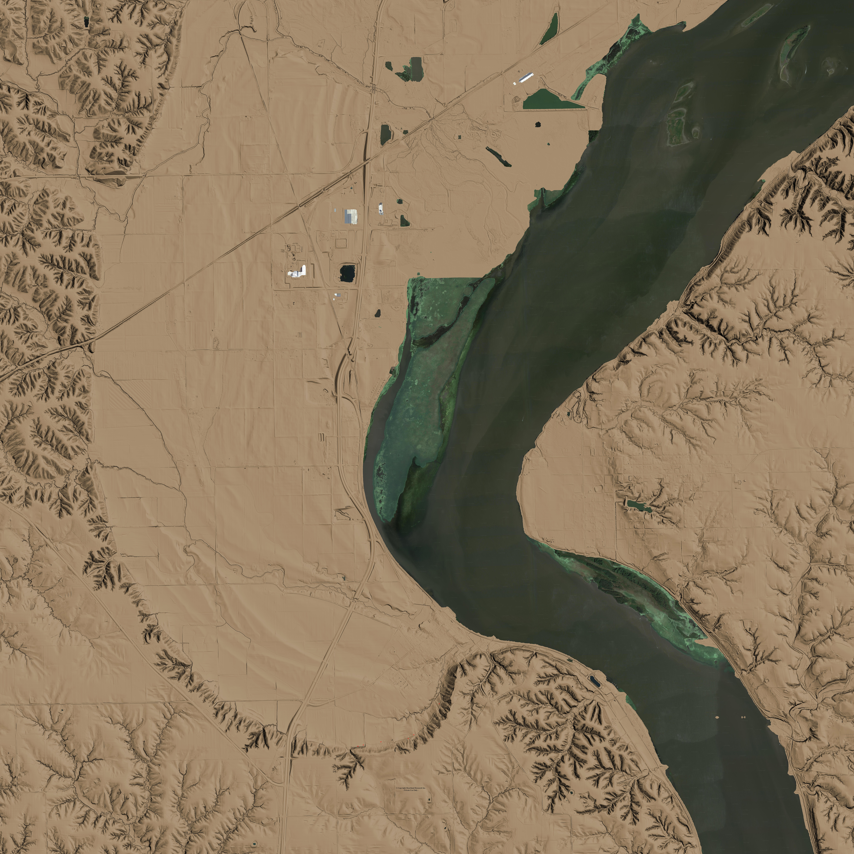
More than a year ago, Heartland Research hired technicians to use the best Leica LiDAR scanner to fly over the PHOENICIA Ship Museum. There were billions of laser light pulses that went to the ground to measure how long it took for each pulse to come back to the airplane. The images on the ground were computed based on the return times of laser pulses.
As the pulse of laser light moves from the air to the ground and back again, the GPS and IMU units determine the scanner’s exact location and attitude. The database now contains the exact coordinates for each laser pulse.
From the area surrounding the PHOENICIA Ship Museum, we have a very large database.
Computer specialist Jay Mackley has decades of experience working with large data bases. He has worked with the data that came from the LiDAR scans. Using high-resolution digital maps, he has now developed interactive maps.
With the Leica Scanner, light pulses were transmitted across a swath of landscape below the aircraft through an oscillating mirror or rotating prism. In the survey, 29 parallel flight lines were drawn over a large area of 34,000 acres. The flight crew was safe from laser pulses, and they had returned to their motels without incident. Through LiDAR scans, we are able to determine what is in the ground in a way that was never possible before.
CLICK HERE TO DISCOVER AN INTERACTIVE MAP FROM THE AREA OF THE PHOENICIA SHIP MUSEUM.
These images are remarkable. With your mouse you can freely see the power of knowledge coming out of the ground. There is an ancient wall surrounding the area that stretches for 10 miles. We believe that 2,000 years before Columbus, a people crossed the Atlantic in ancient ships from the Old World and established a city within the limits of that wall.