The Heartland Research Group Q&A #2 - LiDAR (7/4/2023)


Heartland Research Group Q&A #2 - LiDAR

▪ By Jay Mackley
By Jay Mackley
LiDAR Pass demo

LiDAR Sweep

Q1. What exactly is LiDAR?
A1. LiDAR is an acronym for Light Detection and RAnging. LiDAR sends laser beam pulses from an airplane to create a map based on the reflected light. Later the raw data files are processed to remove vegetation and buildings in order to reveal precise ground elevation and contours.

Q2. Okay so why is the Heartland Research Group generating LiDAR data?
A2. Publicly available LiDAR is currently at a low resolution, so we took the opportunity to have Don Cummins of Air Data Solutions map the Nauvoo area with high-resolution LiDAR on both sides of the Mississippi. In accordance with our Mission Statement, we hoped to find ancient American mounds or other terrain features that would guide our ground research.

LiDAR 29 Passes

29 LiDAR scans including Nauvoo

Q3. How much land was scanned and how detailed is the resolution?
A3. To scan 34,000 acres, Air Data Solutions made 29 passes with each pass at 75438 x 4654 pixels to make 10,181,565,108 pixels total. Each pixel has georeferencing metadata, including GPS coordinates, attached to it.

FootHillsDefenseComp

LiDAR vs Satellite Imagery

Q4. What were the results? Did you find anything?
A4. Some mounds were identified on the Illinois side of the river that we already knew about. On the Iowa side I did not find anything unusual on the farmland. It has been cultivated for nearly 200 years. However, especially south of Montrose I found earthworks in the foothill areas.

UpperFoothillBerm2020a

Jay Mackley stands on berm rising to the top of the bluff south of Montrose. 2021

Q5. I have never heard of this. How did you find it? When did this discovery happen?
A5. With the terrain visualization programs ArcGIS and QGIS, I carefully examined the LiDAR dataset where I discovered the earthwork berms. I announced my findings to the Heartland Research Group on January 23, 2022. On March 27, 2022 an HRG Expedition team examined a part the earthwork berms on the property of local prominent farmer and land owner.

MikeStahlmanCore

Mike Stahlman counts tree rings on Chatfield berm.

Q6. And what did the Expedition Team find out?
A6. Several local farmers are interested friends and supportive of HRG efforts. With permission, a berm earthwork was examined by the Expedition Team as indicated by the LiDAR. Mike Stahlman of the HRG took a core sample from a large tree at the top of the berm and was able to count the rings and date the tree to 1878 (144 years old).

DresserBermLookingSouth

Jeri Mackley stands in front of 7′ berm near Montrose.

Q7. Wow. So what does this mean? Is this proof of an ancient structure?
A7. We do not consider the evidence so far to constitute proof of ancient origin but we do consider the evidence strong enough to warrant additional research. The local land owners say:
1. The berms go back to at least the early 1940’s. At that time they were also forested over.
2. They have no idea where the berms came from or why they are there.
3. The berms are fruitful areas for hunters of ancient artifacts and much has been found there over the years (artifact hunters have told us the same…)
4. The berms are not used for water retention or flood control.
5. Farmland at the top of the bluff (bluff plateau) of the foothills was once used for cattle which destroyed the vegetation and led to flooding which washed out some of the berms in modern times. Removing the cattle solved the flooding problem.

LiDARvsSatView

Berms southwest of Montrose. LiDAR vs Satellite view.

Q8. Why were these earthworks never found before?
A8. Erosion has destroyed parts of the berm so only portions of the whole can be seen by any one farmer. It’s also hidden within the tree line. It took the LiDAR imaging to see that there is a pattern of continuity. It was hidden in plain sight.

bermatdistance2

13′ berm. Photo taken with no leaves on the trees. Near Montrose Iowa.

Q9. How long is this thing? Do you have any idea of the size by volume?
A9. QGIS measurements indicate about 5 miles of berm earthworks which are still extent. Flooding, highways, roads and development has leveled or greatly reduced another 5 miles. The original would have been 9.42 miles which is as far north as the scanning goes. As for volume we need to take more measurements to come to an average size, however my rough estimate is the current remains are probably in the range of 200,000 to 350,000 cu yards for the five miles extent.

GreatSerpentMound

The Great Serpentine Mound in Ohio

Q10. How does that compare to other earthworks in North America?
A10. The Great Serpent mound in Ohio is 1,348 feet long with about 40,000 cu yards. The largest pyramid in North America is Monks mound at Cahokia Illinois at 815,000 cu yards.

FootHillsDefense3

Bottom of photo is top of Montrose bluff area.

Q11. Why go to all the effort to build such a structure?
A11. There are two theories:
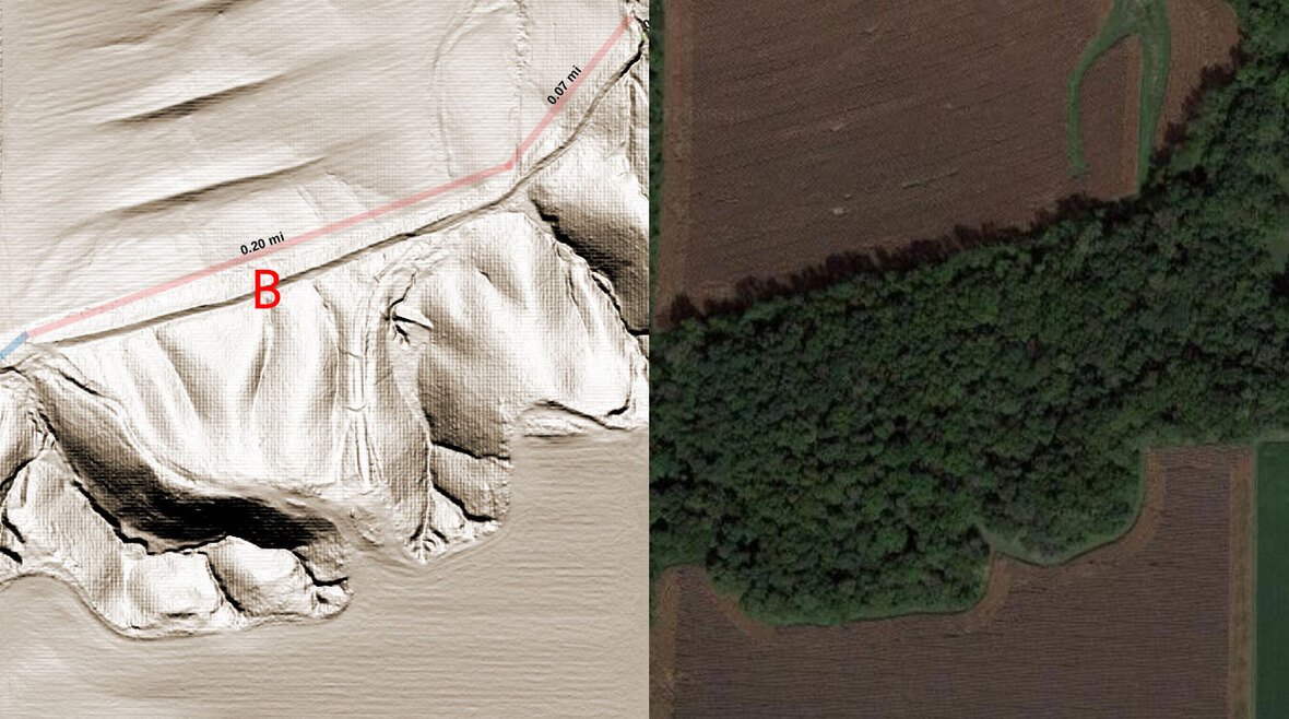
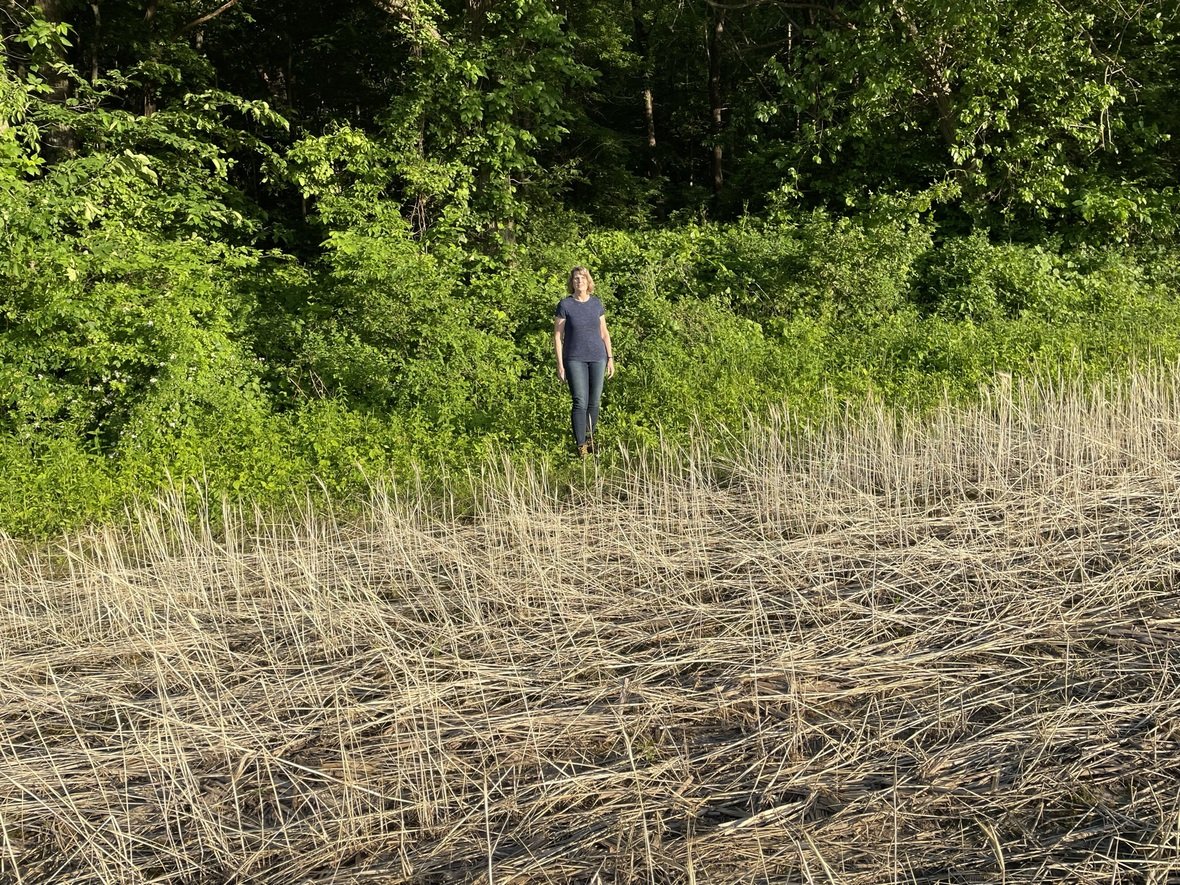
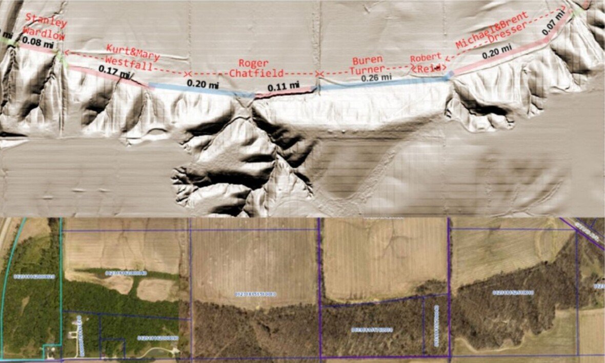
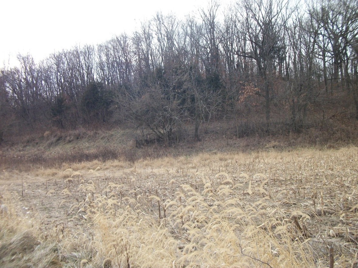
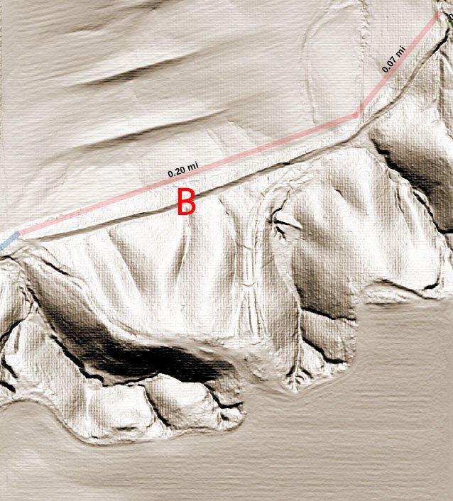
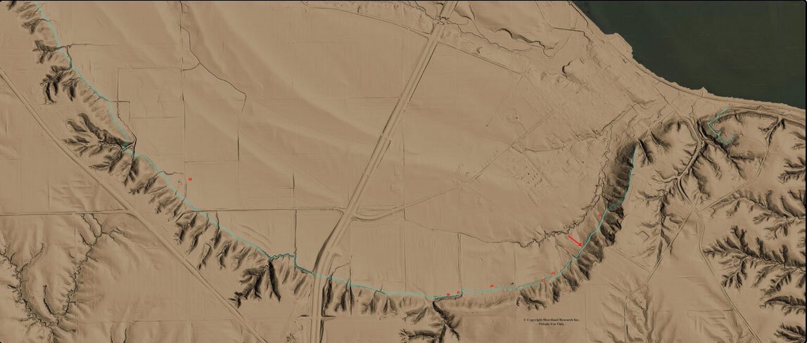
Flood control is one possible answer. You can see two water control berms in the LiDAR image to the right in the middle of the farm field. The earthwork berm is marked as “B”. However, the “B” berm in the bluff does not have the composition or placement to match the profile of a water control berm and only a few of the berms have any water near them.

At this point inquiries have produced no written or oral record of construction.

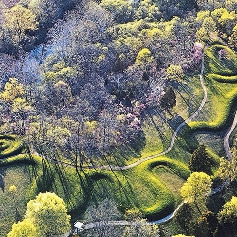
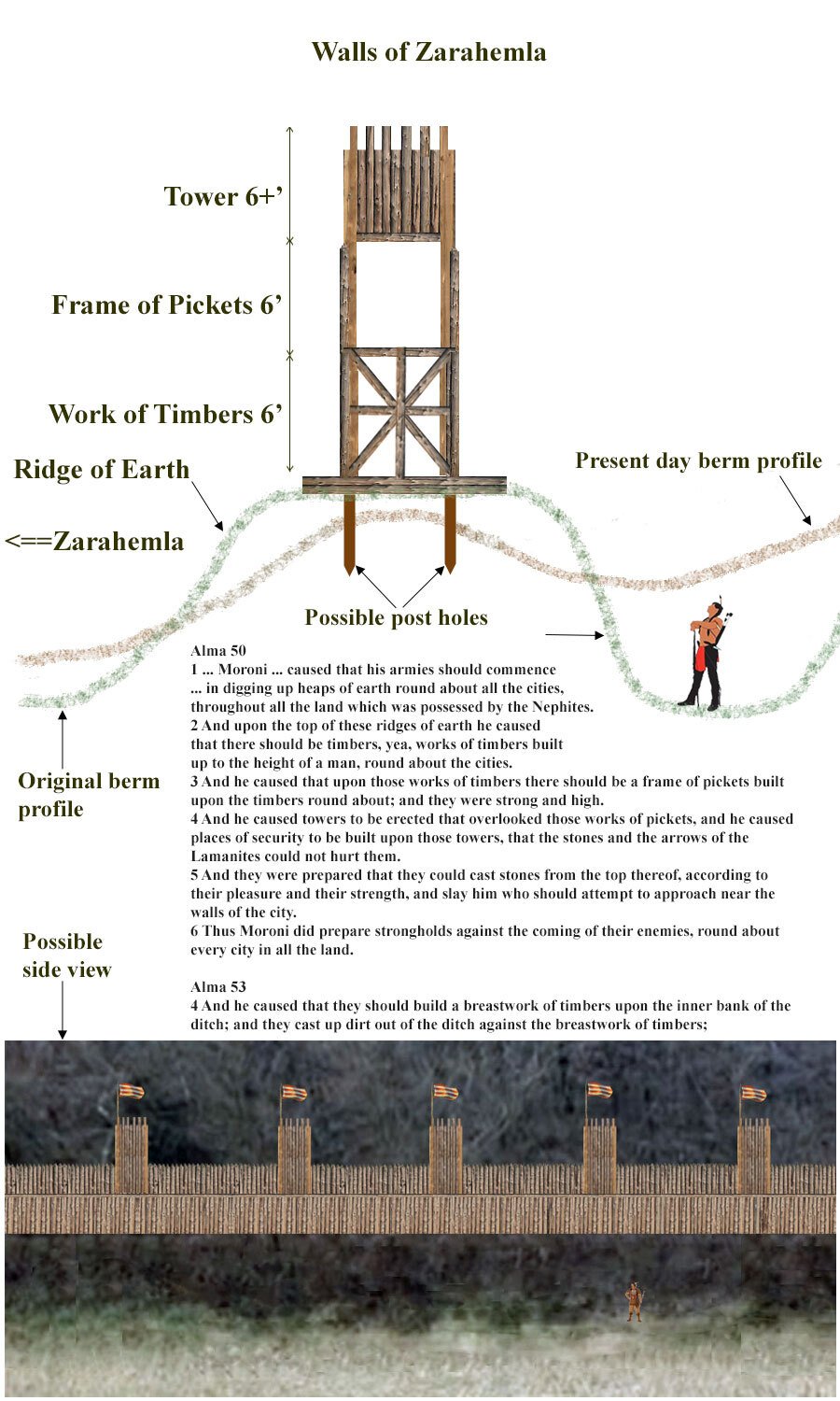
The other theory is one of military use. The berm may have once formed the foundation for a defensive wall. There are detailed accounts in the Book of Mormon of how defensive walls were built and how they involved wooden palisades and earthwork berms.

There is no proof or conclusive evidence for any theory at this point and more evidence is needed to show an ancient origin.

ZarahemlaWallSideView2

Q12. What are your future plans for this?
A12. We need more field work and more information but this year has absorbed all HRG resources with the Phoenicia restoration, land acquisition and museum planning. We would like to excavate several areas along the berms as soon as we can find the time, money, and expertise to do so. Excavation can help answer questions of construction technique, size, and age. The crops need to be off the fields so the earliest possible time would be a 2024 date.

LidarFull
▪ Jay Mackley
Jay Mackley
 

Leave a Comment

Your email address will not be published. Required fields are marked *

PHP Code Snippets Powered By : XYZScripts.com
Scroll to Top